U.S. Historical Series
A series of historical maps that illustrate the progression of American history. The first map shows American Indian territories pre-colonization. Subsequent maps that depict the original 13 colonies, American Revolution battle sites, the Louisiana Purchase expanding U.S. territory, the Gadsden Purchase in the southwest, and an 1836 map that graphically describes our country divided during the Civil War. These visual aids provide a comprehensive overview of key events and territorial changes in U.S. history, highlighting the evolving landscape and interactions between various groups.
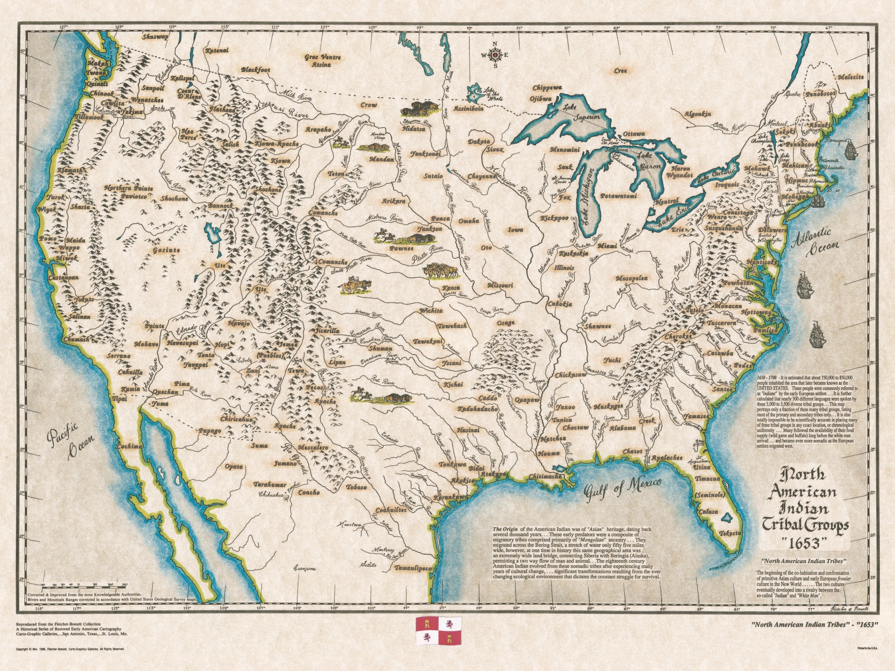
North American Aboriginal Tribes 1653
There were about 850 thousand Indians populating this land, with about 300 different languages spoken. It is estimated that there were nearly 3,500 diverse tribal groups which migrated across the Bering Strait from Siberia and Mongolia.
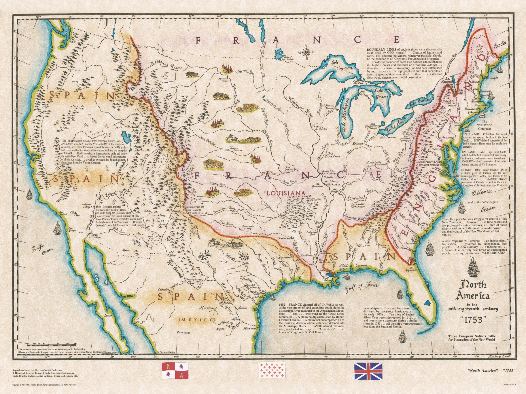
North America in 1753
In 1753, North America was a diverse landscape of colonial territories and indigenous nations. European powers involved included Great Britain, France, Spain. These countries were engaged in territorial disputes and colonial expansion, particularly in regions such as the Ohio River Valley. The competition for resources and influence among these nations eventually sparked the French and Indian War in 1754, leading to significant shifts in power dynamics in North America.
France claimed all of the territorial domain whose watersheds drained into the Mississippi River. The British Crown claimed all of the watershed drainage which flowed into the Atlantic Ocean from the Appalachian Mountain Range. This left Spain with the watershed drainage of the Gulf of Mexico, with the exception of the Mississippi River watershed. Spain also claimed territorial domain west of the Continental Divide, all the way to the Pacific Ocean.
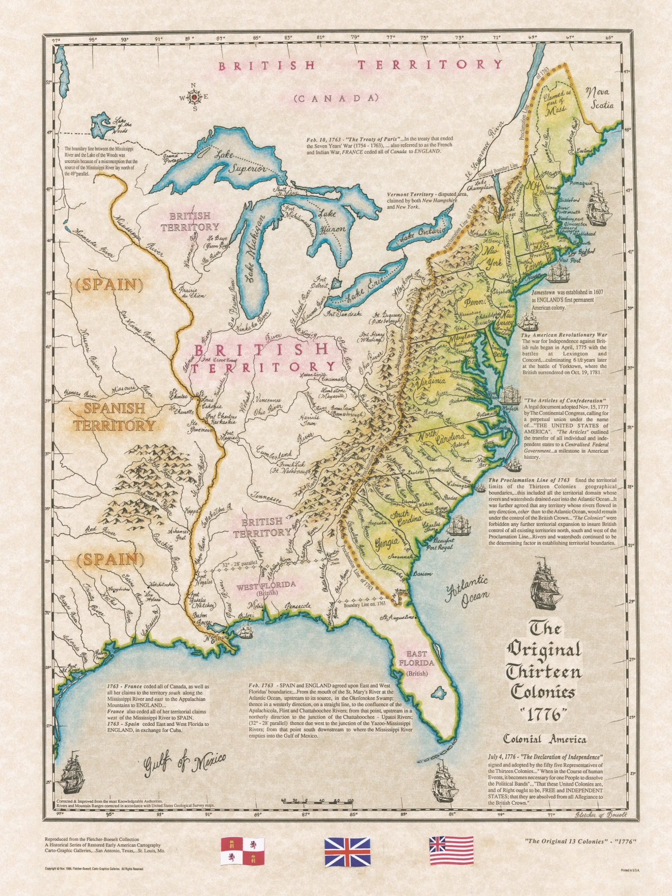
The Original 13 Colonies 1776
The original 13 colonies in North America were established by various European powers, primarily England, between the 17th and 18th centuries. These colonies were organized into three main regions: New England (including Massachusetts, Rhode Island, Connecticut, and New Hampshire), the Middle Colonies (including New York, New Jersey, Pennsylvania, and Delaware), and the Southern Colonies (including Maryland, Virginia, North Carolina, South Carolina, and Georgia). Each colony had its own government, economy, and unique social and cultural characteristics.
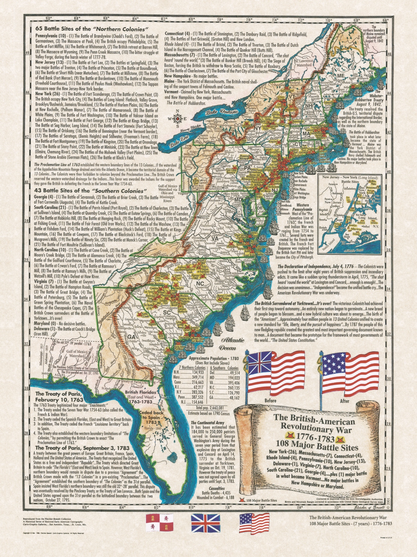
The American Revolution Battle Sites 1776-83
A historical map showcasing American Revolution battle sites spanning from 1776 to 1783 that details key engagements such as the Battles of Lexington and Concord, Saratoga, and Yorktown. This map illustrates the geographic spread of conflicts from the coast of Maine to Georgia, highlighting significant events like the Siege of Boston, Battle of Bunker Hill, and the decisive victory at Yorktown. This visual representation offers insights into the strategic importance and outcomes of pivotal Revolutionary War battles.
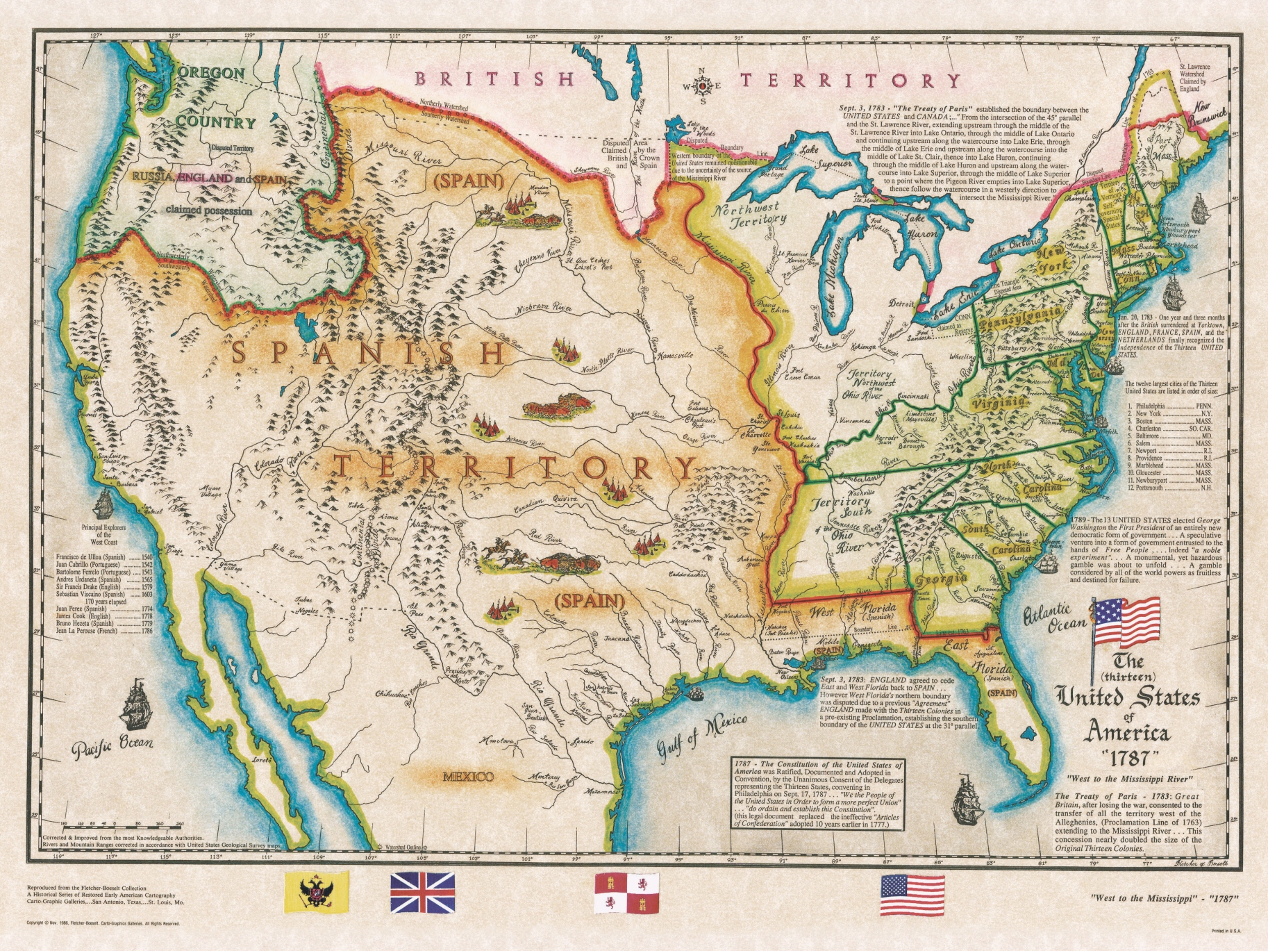
The 13 United States
The Original 13 States extended to the Mississippi River. The Treaty of Paris in 1783 recognized the new fledgling nation after the Revolutionary War. The Colonists were victorious in doubling the size of the Original Colonies. A new beginning, a new type of government. A government Of the People, For the People and By the People. A new concept, a new and higher standard of Life, Liberty and the Pursuit of Happiness. Not only 13 new States but 13 unified States.

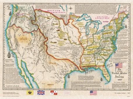
Louisiana Purchase 1803
The Louisiana Purchase of 1803 doubled the size of the United States, stretching from the Mississippi River to the Rocky Mountains. The map showcases the acquisition of land from France, encompassing present-day states such as Louisiana, Arkansas, Missouri, Iowa, Oklahoma, Kansas, Nebraska, and parts of Minnesota, North Dakota, South Dakota, New Mexico, Texas, and Montana.

The 17 United States - Louisiana Purchase 1803
This was the largest and most complicated real estate venture of the New World. This doubled the size of the fledgling "Republic". This huge parcel of land was first claimed by Spain, then ceded to France, then ceded back to Spain. It was then secretly ceded back to France and eventually sold to the United States, by Napoleon in 1803. This enormous parcel of land would become the future soil of 15 states.
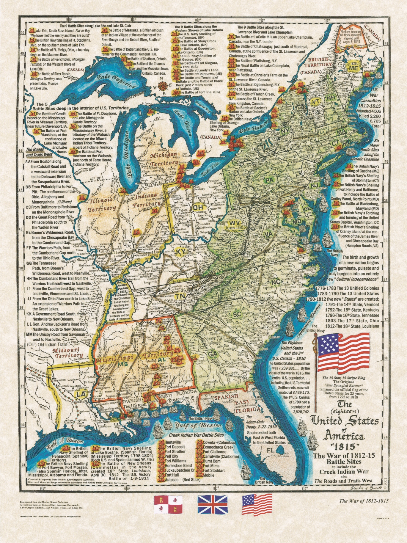
The War of 1812
The War of 1812 is sometimes called the "Second War of Independence". It was fought until 1815 between the United States and Great Britain. This conflict was caused mainly by the US resentment of British naval harassment. The British were already at war with France. They seized American ships and took seamen from them, some who were US citizens. The British also attempted to keep US ships from reaching French ports.

The U.S. Mexican War 1846-48
Down south the Mexican Army crossed the Rio Grande in an attempt to regain possession of Texas. This ignited the fuse that led to the U.S.-Mexican War 1846-48. Not only did Mexico lose the war but all the territory below the 42nd parallel, south to the Gila River.
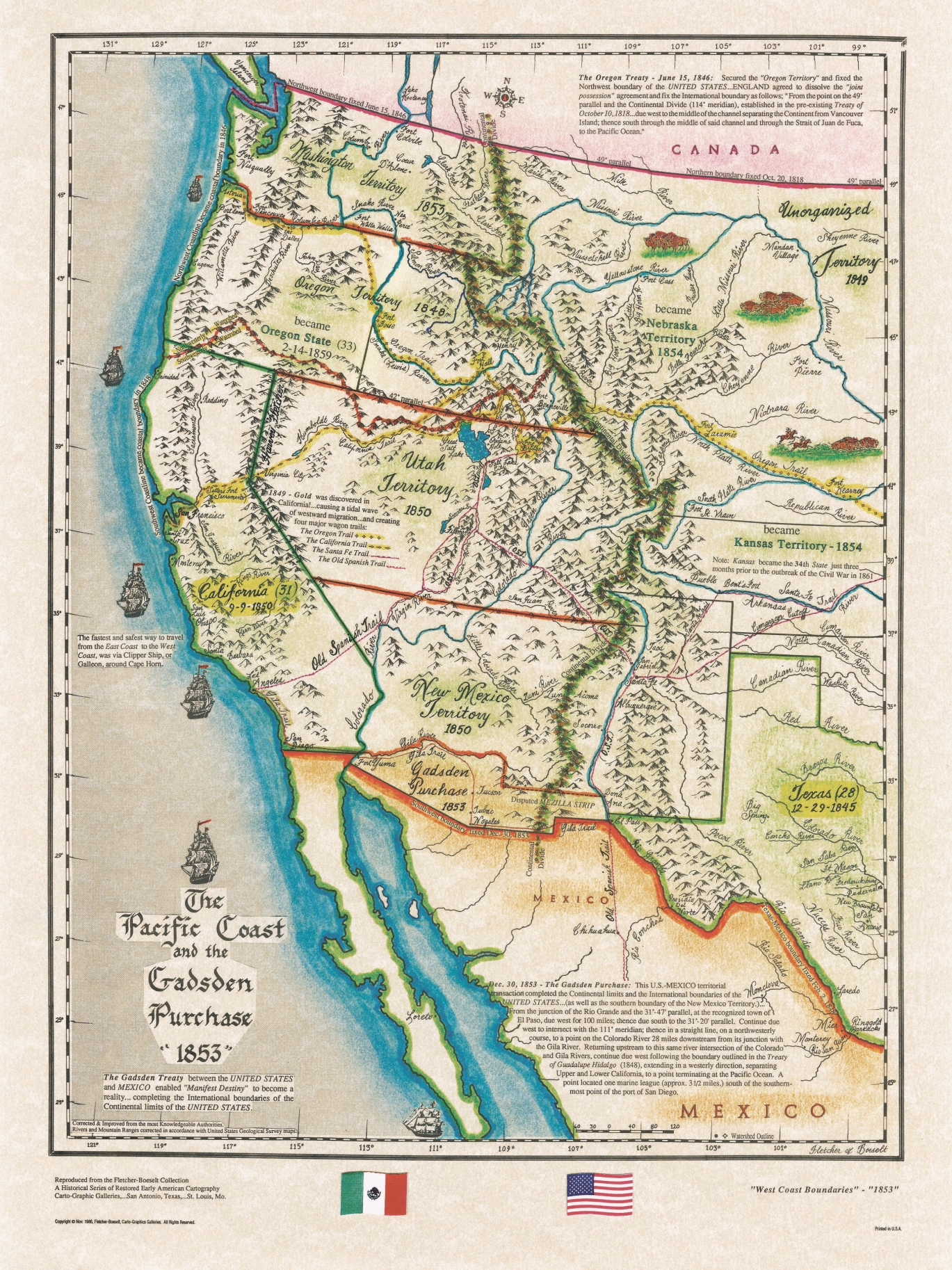
The Gadsden Purchase 1853
The Gadsden Purchase was a transaction in 1853 between the United States and Mexico. The U.S. acquired a strip of land in present-day southern Arizona and southwestern New Mexico for $10 million. The purchase aimed to facilitate the construction of a southern transcontinental railroad route. Named after U.S. Minister to Mexico James Gadsden, the acquisition expanded American territory, helping to solidify borders and advance transportation infrastructure in the growing nation.
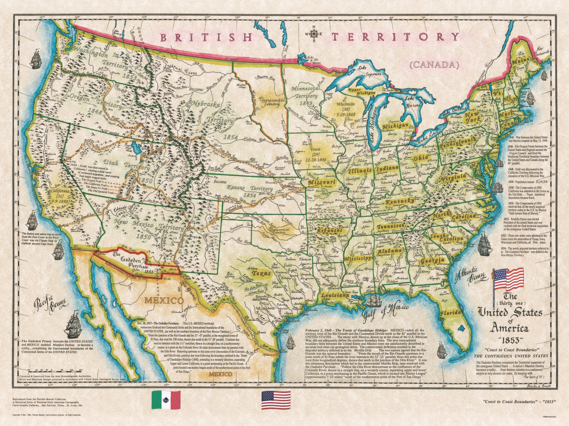
The United States 1853 Coast to Coast
A map of 31 United States after California was admitted as the 31st State. The State of California was created without hesitation as outlined in the famous "Compromise of 1850" which also ended the choice of entering the Union as a "Slave State" or a "Free State". It also created 2 U.S. Territories, New Mexico Territory and Utah Territory, and established statehood boundaries of Texas.

The 35 United States - 11 Southern States Secede
This 1863 map of the United States graphically describes our country divided, 11 of the 15 slave states seceded from the Union, however, 4 of the slaves states remained with the Union, Missouri, Kentucky, Maryland and Delaware. Plus West Virginia which seceded from Virginia when she secede from the Union. Note this map was drawn with all 35 states intact, then split to graphically show a nation divided.


