United States Territories 1861-1868
Maps of US territories from 1861 to 1868 highlight dramatic changes, showing a western landscape divided into vast, newly organized territories such as Dakota, Nevada, Colorado, Arizona, Idaho, and Montana. Borders were often provisional and irregular, shaped by Congressional acts as settlers moved west. These maps illustrate the gradual dissolution of larger territories like Nebraska and Utah, marking a dynamic era of territorial reorganization and westward expansion.
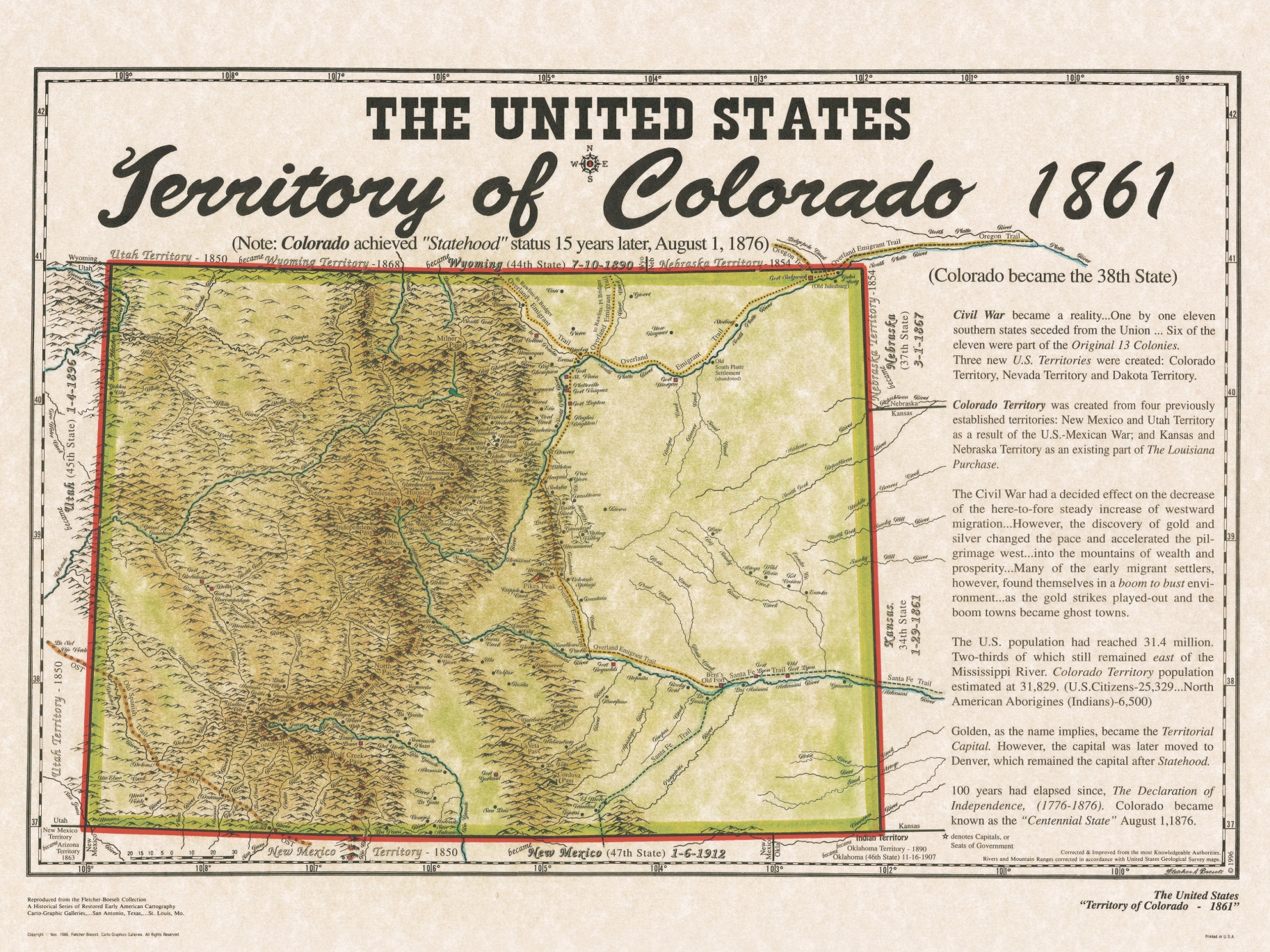
Colorado Territory 1861
Colorado became a US territory on February 28, 1861, formed from parts of Kansas, Nebraska, Utah, and New Mexico territories. The discovery of gold in 1858 in the Pike’s Peak region sparked rapid settlement, leading to its territorial status. Denver became the main settlement, while the territory’s economy centered on mining. Colorado’s population was diverse, including miners, settlers, and Native American tribes.
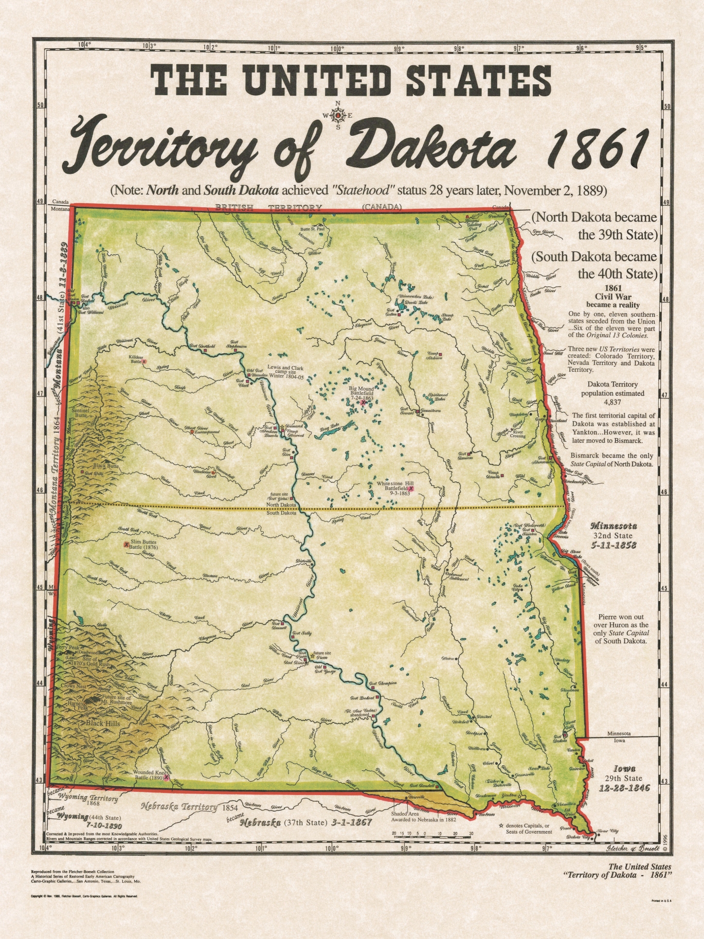
Dakota Territory 1861
Dakota Territory was established on March 2, 1861, covering modern North and South Dakota, and parts of Montana and Wyoming. Created from northern Nebraska and parts of Minnesota Territories, it was vast and sparsely populated, mainly by Native American tribes, fur traders, and a few settlers. The capital was Yankton. The government promoted settlement and infrastructure, but Native resistance and harsh climate challenged development. Later, it was divided into smaller territories.
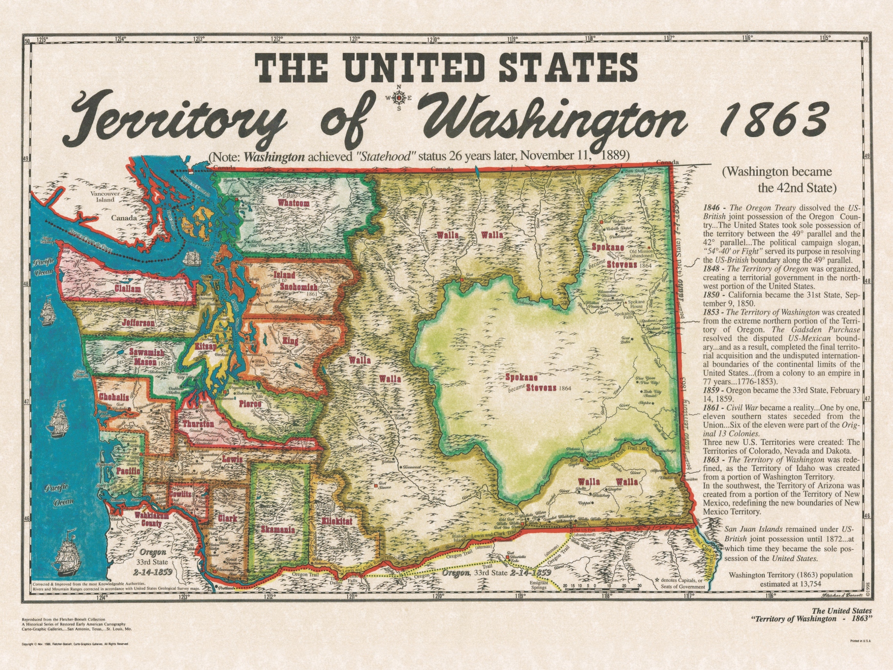
Washington Territory 1863
In 1863, Washington Territory included today’s Washington state and northern Idaho. It was smaller than its original 1853 boundaries, having lost land with the creation of Idaho Territory that year. Olympia was the capital, and the region remained sparsely populated, with Native American nations, fur traders, and growing numbers of settlers. The economy relied on logging, fishing, and farming, while ongoing settlement and transportation improvements gradually increased population and development.
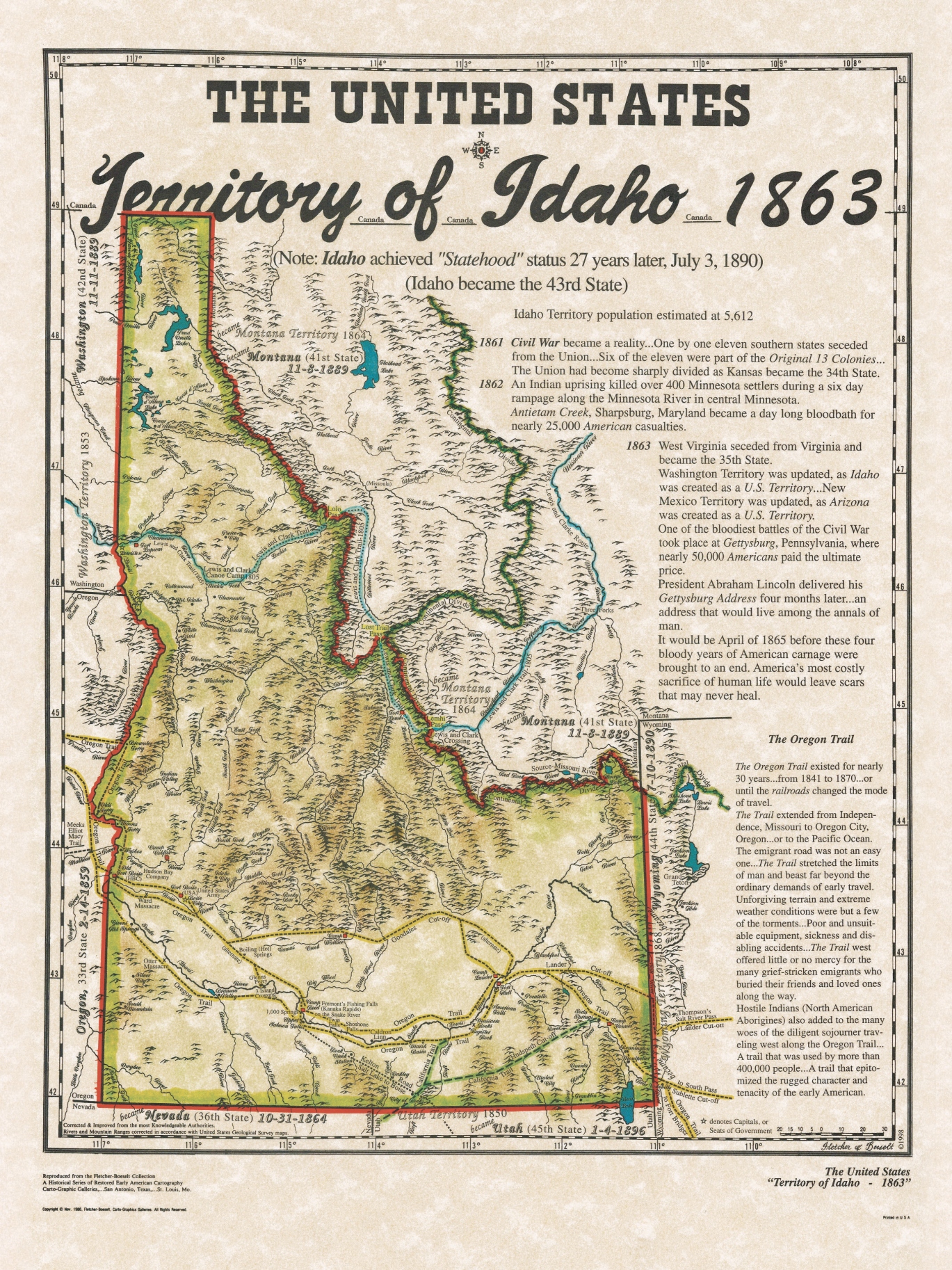
Idaho Territory 1863
Idaho Territory was created on March 4, 1863, from parts of Washington, Dakota, and Nebraska territories. Initially, it included present-day Idaho, Montana, and most of Wyoming, making it vast and largely unsettled. Lewiston served as its first capital. The economy was driven by gold and silver rushes, drawing miners and settlers. Native American tribes inhabited most of the region, and rugged terrain made travel difficult. The territory was later divided into smaller states and territories.
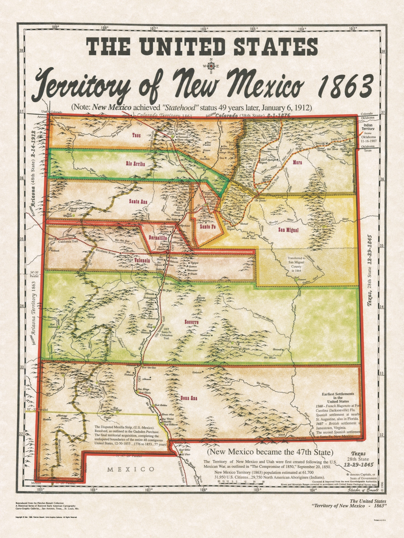
New Mexico Territory 1863
In 1863, the U.S. Congress passed the Arizona Organic Act, splitting the original New Mexico Territory along a north-south line at the 109th meridian. This created the new Arizona Territory from the western half, while the eastern portion remained New Mexico Territory. This division was influenced by political, military, and geographic considerations during the Civil War, shaping modern state boundaries in the Southwest United States.
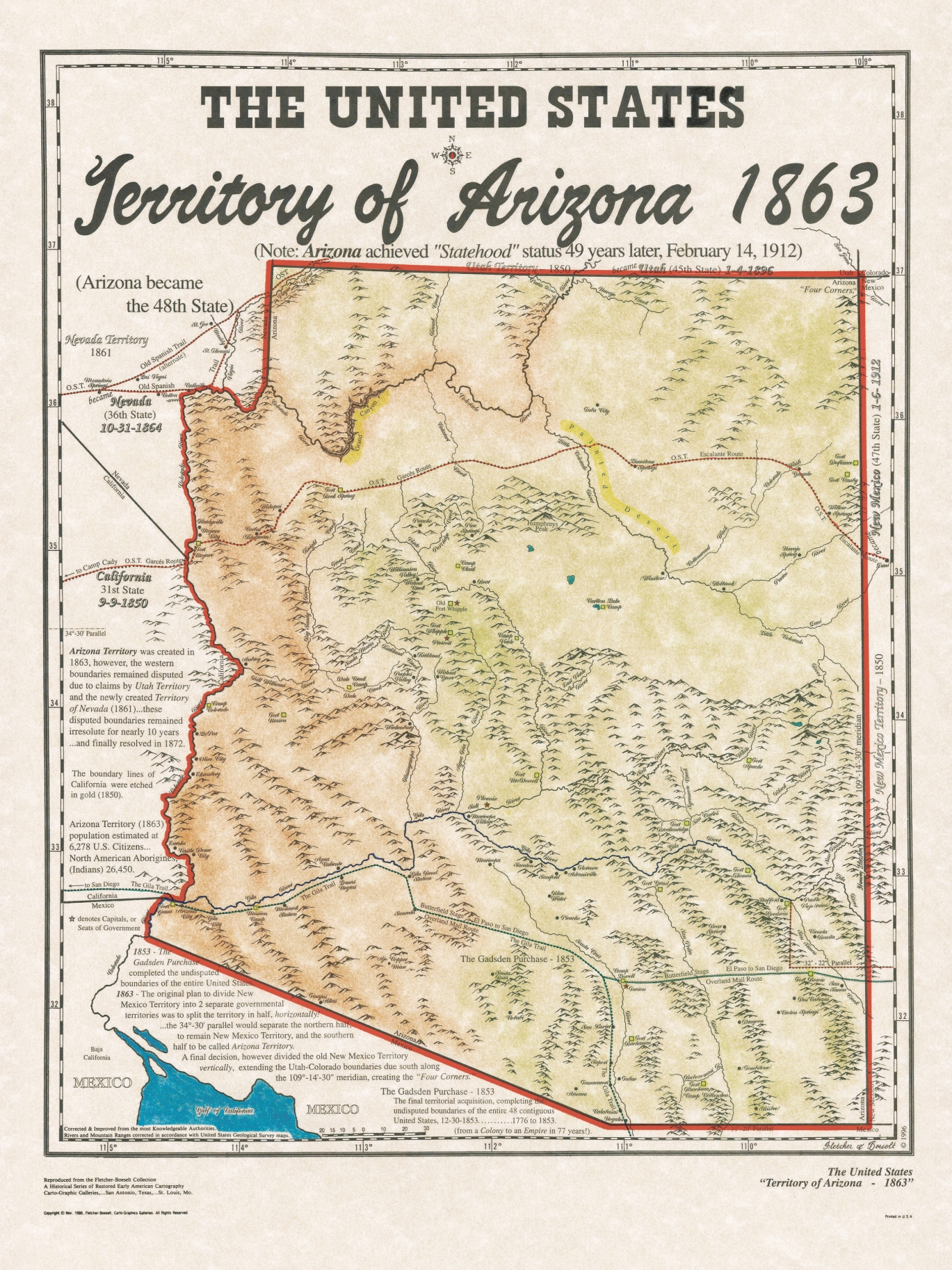
Arizona Territory 1863
In 1863, the Arizona Territory was established from the western half of the New Mexico Territory by the U.S. Congress through the Arizona Organic Act. Bordered by California, New Mexico, Utah, and Mexico, it included present-day Arizona. Created during the Civil War, the territory attracted settlers, miners, and military outposts, marking the beginning of Arizona’s distinct territorial identity and later statehood in 1912.
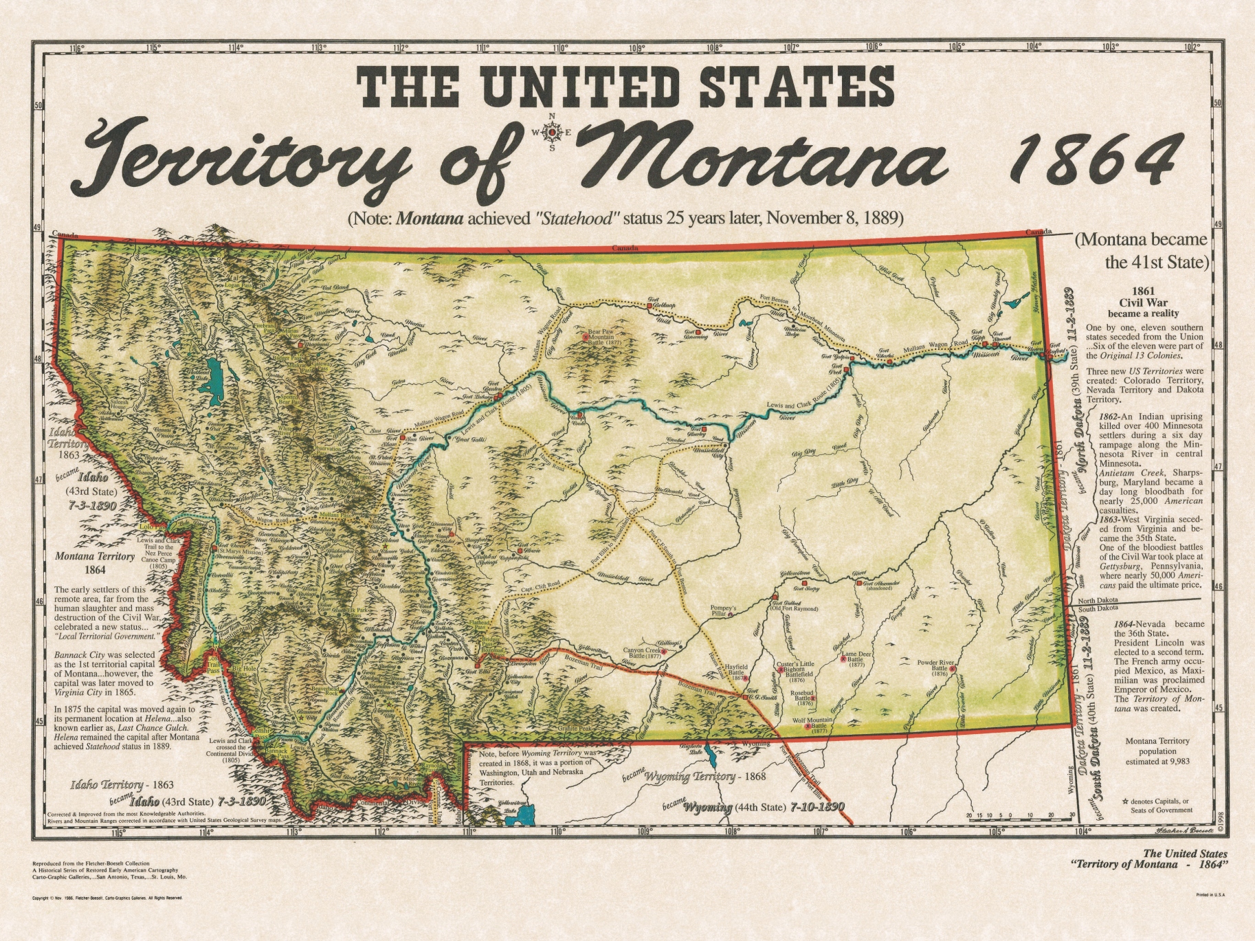
Montana Territory 1864
In 1864, Congress created the Montana Territory from parts of Idaho Territory, Dakota Territory, and Nebraska Territory due to rapid population growth from gold discoveries. The Organic Act, signed by President Abraham Lincoln on May 26, 1864, officially established Montana Territory. It included present-day Montana’s area, with Bannack as its first capital, setting the foundation for statehood in 1889 and encouraging further settlement and development.
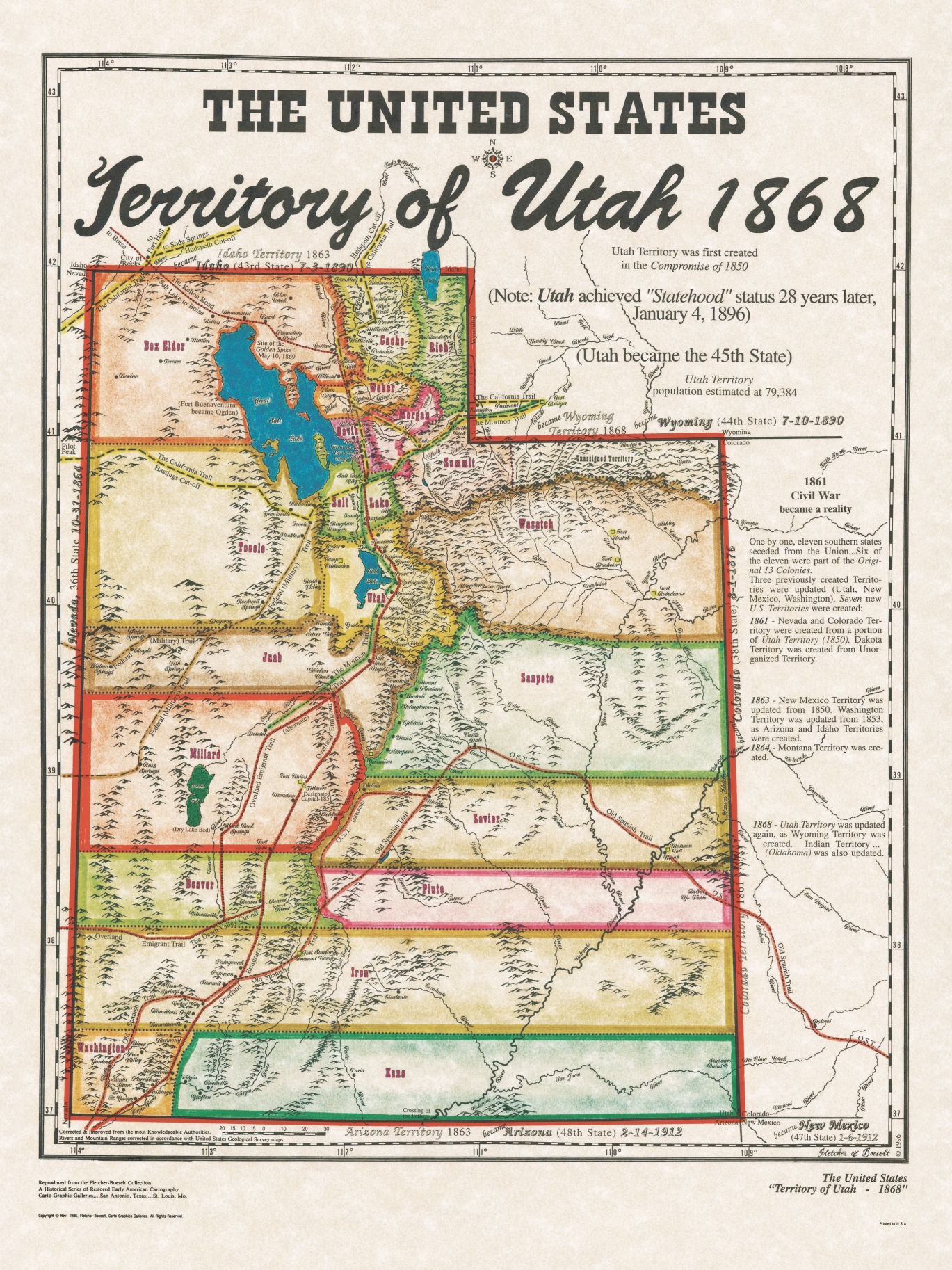
Utah Territory 1868
In 1868, the boundaries of Utah Territory were finalized after Wyoming Territory was created from its northeastern portion. Originally established in 1850, Utah Territory lost land several times to form new territories. The 1868 adjustment set its modern borders, shaping present-day Utah. This division was influenced by westward expansion, political negotiations, and the construction of the transcontinental railroad, paving the way for Utah’s statehood in 1896.
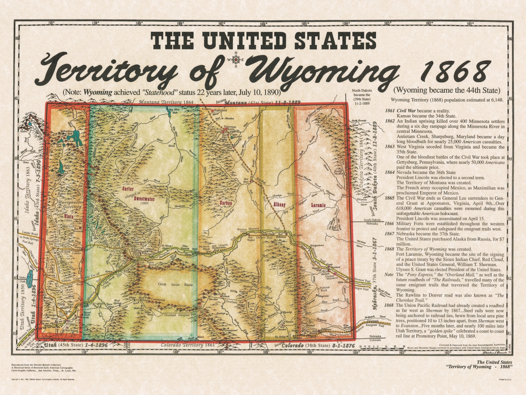
Wyoming Territory 1868
In 1868, the Wyoming Territory was officially created by Congress, carved from parts of Dakota, Utah, and Idaho territories. Spurred by the arrival of the Union Pacific Railroad and westward expansion, Wyoming’s boundaries were drawn to include future economic and transportation hubs. Its establishment ensured better governance for settlers, set the stage for rapid development, and paved the way for Wyoming’s statehood in 1890.
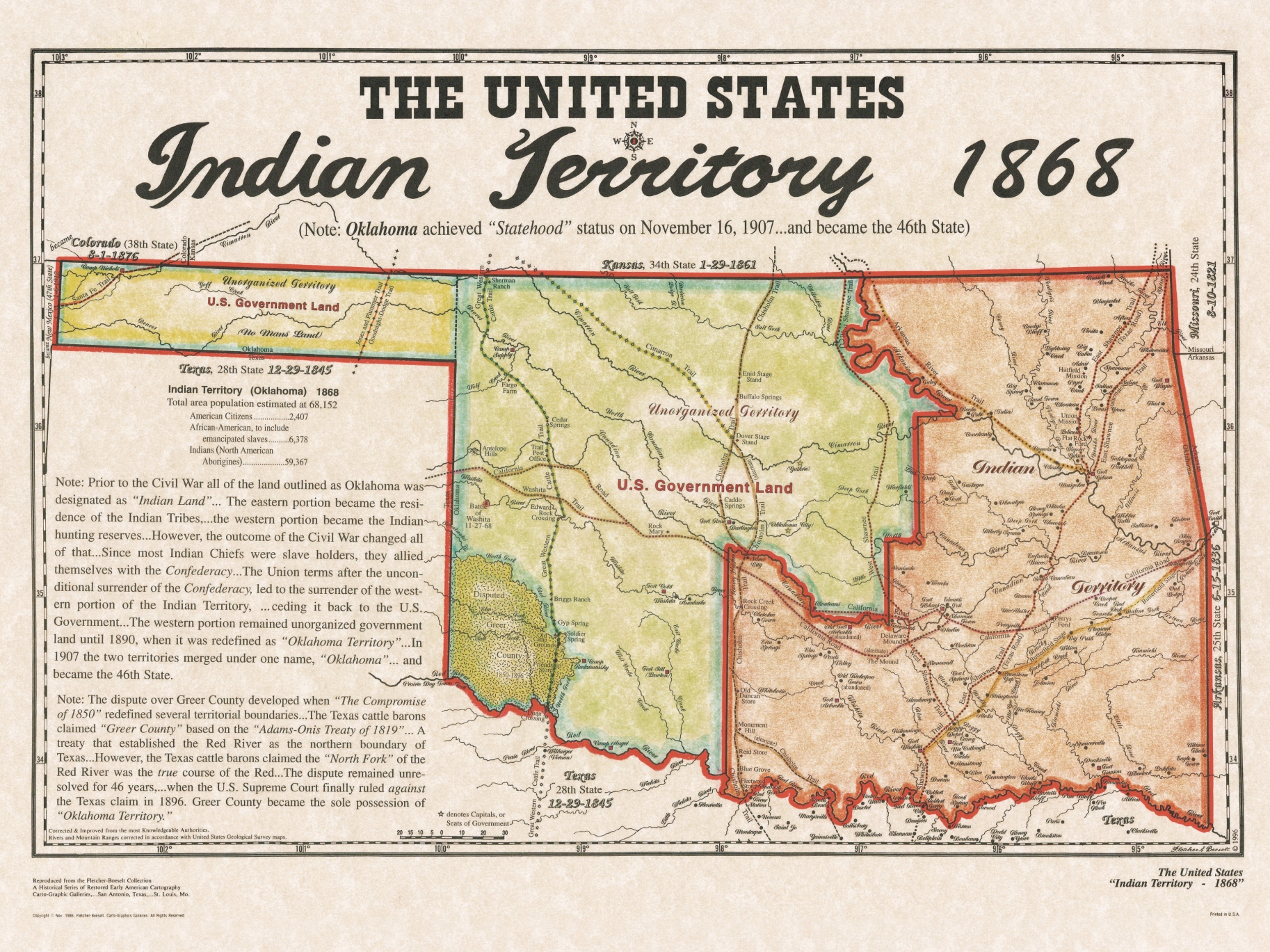
Indian Territory 1868 (Oklahoma)
In 1868, Indian Territory—now largely Oklahoma—was officially recognized as a region for relocating Native American tribes forcibly moved from their ancestral lands in the eastern United States. The territory was established through a series of treaties and federal acts, concentrating displaced tribes like the Cherokee, Chickasaw, Choctaw, Creek, and Seminole on designated lands. The U.S. government’s intention was to relocate Indigenous peoples west of the Mississippi River, fundamentally reshaping tribal life and the region’s demographic landscape.


